SWITZERLAND
SWISS MOUNTAINS
|
ALL ABOUT SWITZERLAND |
|
HIKING GUIDE SWISS MOUNTAINS |
|||||
|
Switzerland maintains an excellent network of hiking trails, both in the soft hills of densely populated Mittelland/plateau between Lake Geneva and Lake Constance and in the mountains (Alps, Jura). |
||||
 Strada Alta (Leventina) |
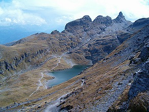 Five Lakes Route (Pizol) |
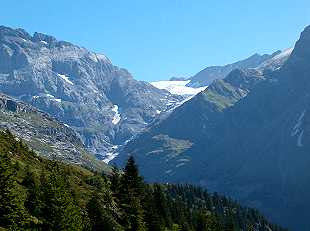 Maderanertal |
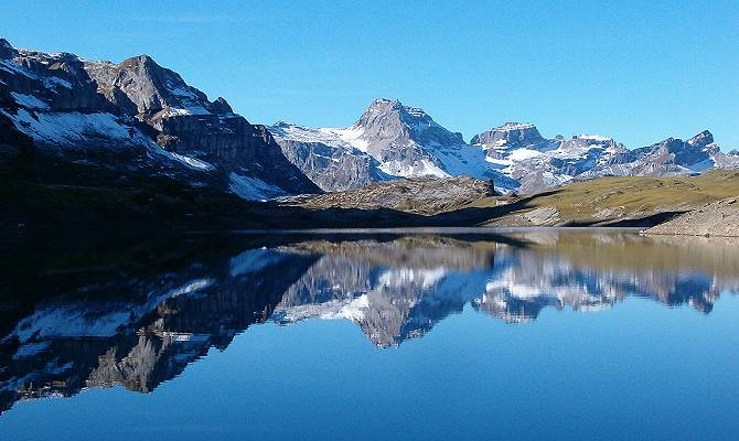 Glattalp |
|
|
Switzerland's population even accepted an amendment to the constitution on February, 18th, 1979 stating that the administration is obliged to support private efforts in creating and maintaining hiking paths: A parliamentary counter-proposal to a popular initiatives in Switzerland's direct democracy - and even with a spectacular majority of 1467357 (78%) Yes-votes vs. 424058 (22%) No-votes.
Actually, hiking has a much older tradition in Switzerland. Maintenance
and markings are performed by volunteers organized in 26 cantonal
hiking associations. The article in Switzerland's federal constitution
is therefore a legal ground for subsidies but foremost an expression
of recognition. |
||||
 |
|
 |
Brown signpost for a historical hiking trail (Jakobsweg = pilgrimage route to Santiago de Compostela) |
 |
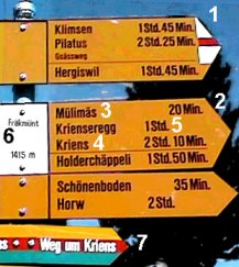
Markings on rocks, posts or trees facilitate orientation between signposts. (Mountain trails: white-red-white, hiking trails in relatively flat terrain: yellow). In flat terrain yellow metal plates or arrows are used frequently. |
|||
Blue signpost arrows and white-blue-white markings indicate routes in the alps that might lead through zones without any trail, over large fields of snow or glaciers (even in summer) or through steep rocks. These routes are reserved to experienced climbers and should only be used when guided by a qualified alpine guide. |
 | |||

Short quotations allowed but with precise declaration of origin (Link).
Reproduction of substantial parts and pictures in printed or electronic form
only with explicit written consent by the editor.
| Disclaimer | Privacy Policy | www.all-about-switzerland.info © 2005-2010 All Rights Reserved | Editor | ||