SWITZERLAND
GLATTALP
|
ALL ABOUT SWITZERLAND |
|
HIKING PICTURES GLATTALP |
|||||
|
Hiking Central Switzerland · Maderanertal · Glattalp Eastern Switzerland · Pizol - 5 Lakes Southern Switzerland · Strada Alta |
|
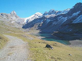 |
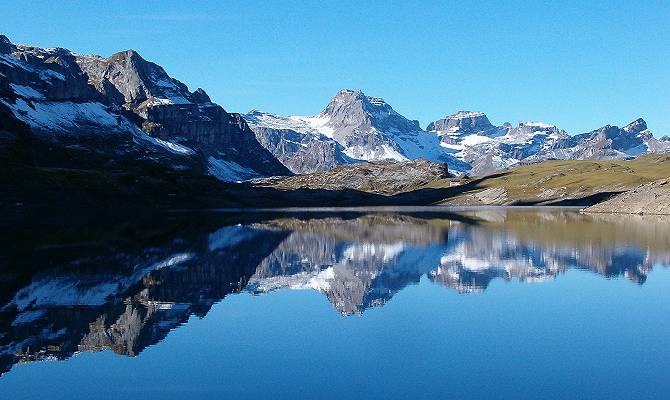
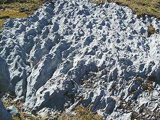
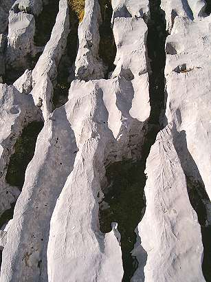 Glattalp is an example of karst topography (also called karst fields) in Switzerland. |
|
| ||
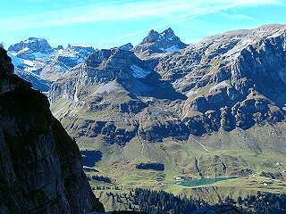 Looking back to the other side of Bisistal |
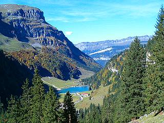 On our way back downhill to Sali bus stop |
See more photos from Glattalp.
See where these photos were taken:
During summer (June, 8th to October, 14th), Glattalp may be reached by public bus and cableway from Schwyz - Muotathal. Take bus (line 1) from Schwyz train station to Muotathal, change at Muotathal post office to a smaller bus (line 6) to get to the end of the Bisisthal valley. At the terminal bus stop Sali there is a cableway going up to Glattalp.
| Station | Time | Station | Time | |
|---|---|---|---|---|
| Basel | dep. 6:04 |  public bus ready for return to Muotathal | ||
| Zurich | dep. 7:09 | Olten | dep. 6:32 | |
| Zug | dep. 7:32 | Lucerne | dep. 7:21 | |
| Arth-Goldau | arr. 7:48 | Arth-Goldau | arr. 7:47 | |
| change -> | Arth-Goldau | dep. 7:54 | ||
| Schwyz | arr. 8:01 | |||
| Schwyz | dep. 8:06 | |||
| Muotathal, post office | arr. 8:34 | |||
| Muotathal, post office | dep. 8:35 | |||
| Sali Talstation | arr. 9:01 | |||
| On Saturdays and Sundays, you may start from Schwyz at 8:06 as well as 10:06 with arrival at Sali at 9:01 and 11:01 respectively. Trains run once per hour anyway. | ||||

Short quotations allowed but with precise declaration of origin (Link).
Reproduction of substantial parts and pictures in printed or electronic form
only with explicit written consent by the editor.
| Disclaimer | Privacy Policy | www.all-about-switzerland.info © 2005-2010 All Rights Reserved | Editor | ||